 English
 Ελληνικα
(By Takis Galanopoulos)
The file below, after downloading, requires Google Earth application to view:
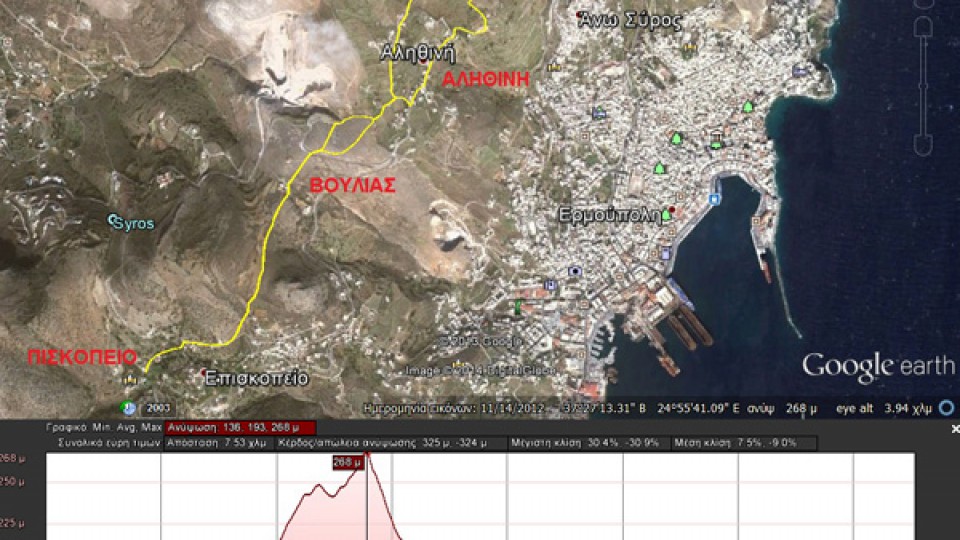
PISKOPEIO_BOYLIA_AGIOS_AUANASIOS
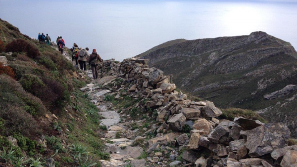
Total length (with return) : 7.540 m.
Altitudes: start at Piskopio = 160 m., Max altitude = 267 m. , Min altitude = 135 m.
Total altitude difference : 323 m.
Maximum slope : 30%, average slope : 8 %
For viewing ... Read More


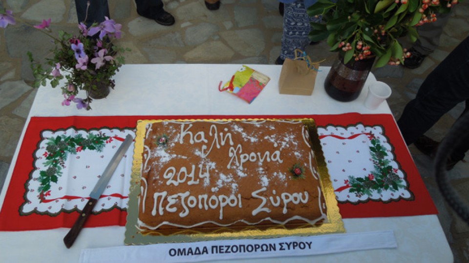
Archive: 2014
02
Feb2014
26
Jan2014
(By Takis Galanopoulos)
The file below, after downloading, requires Google Earth application to view:
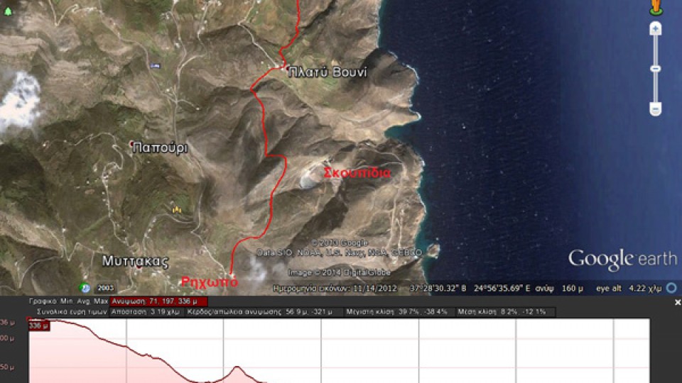
RIXOPO_PLATI_BOUNI_LOULAS
For viewing you have to use the Google Earth application which can be downloaded here:
http://www.google.gr/intl/el/earth/download/ge/agree.html
30
Mar2014
(By Takis Galanopoulos)
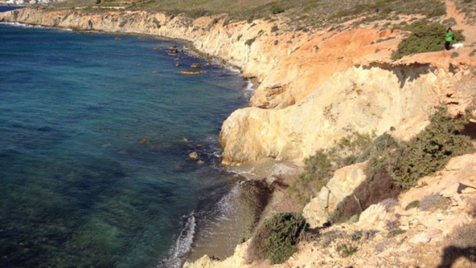
The file below, after downloading, requires Google Earth application to view:
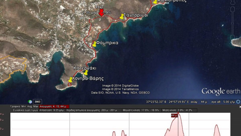
AZOLIMNOS_XONTRA_BARHS
Total path length : 9.250 m.
Maximum altitude : 44 m.
Total altitude difference : 203 m.
Maximum slope : 17%, average slope : 4 %
For viewing you have to use the Google Earth application which can be downloaded here:
http://www.google.gr/intl/el/earth/download/ge/agree.html
02
Feb2014
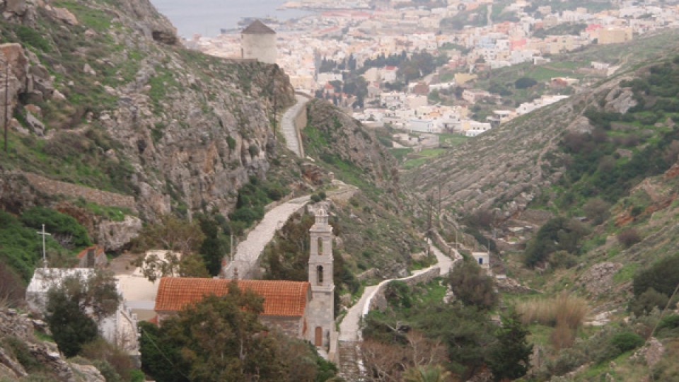
From Piskopio to Voulia
Alithini
St. Athanasios
Error: The video (http://www.youtube.com/watch?v=gbzr46pbBTs) couldn't be embedded.
09
Jan2014
05
Jan2014
By Takis Galanopoulos:
Soon we will add more of these files on our web site.
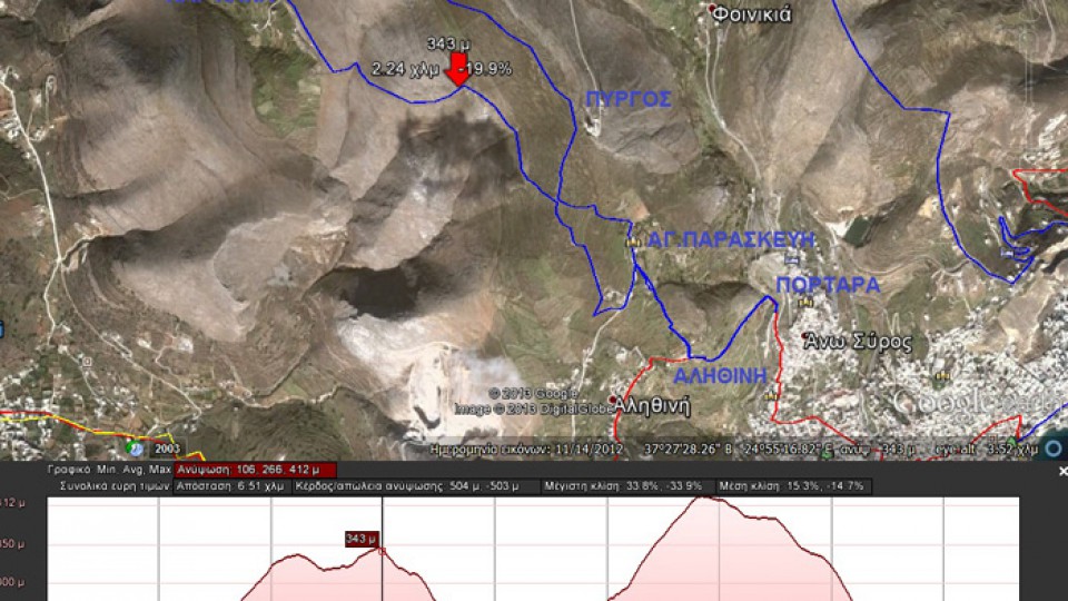
Path length: Start+116 m., we headed up to +346, than at Hartiana at +217, headed to Pyrgos at +412 then got down to +116.
Total 504 altitude metes. Maximum slope 34%, average slope 15%.
The file below, after downloading, ... Read More
27
Jan2014
Total length (with return) : 6,380 m.
Altitude: Richopo = 336 m., Platy Vouni = 161 m. , Loulas = 71 m.
Total altitude difference : 265 + 56 = 321 m.
Maximum slope : 40%, average slope : 10,1 %
The walk today (26-1-2014) was done under the rain mainly during return. 15 ... Read More