 English
 Ελληνικα
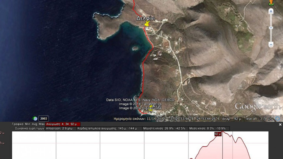
(By Takis Galanopoulos)
The file below, after downloading, requires Google Earth application to view:
KINI_DELFINI_VARVAROUSSA
For viewing you have to use the Google Earth application which can be downloaded here:
http://www.google.gr/intl/el/earth/download/ge/agree.html


Category: Google Earth paths @en
08
Apr2014
26
Mar2015
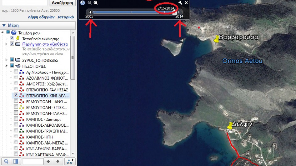
By Takis Galanopoulos.
It was found that when Google Earth sends the aerophotograph, there are Differences in route files,-kmz type - created by earlier aerophotographs .In order not to be observed such differences, each kmz file should be watched on the aerophotograph on which it was designed. This can be done ... Read More
03
Jun2014
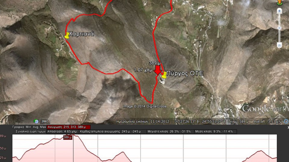
(By Takis Galanopoulos)
The file below, after downloading, requires Google Earth application to view:
TAVERNA_MARGARO_PYRGOS_OTE_XARTIANA_PLATOS
Path length : 4.650 m.
Altitude start : 325 μ. – Max altitude : 389 m. – Min Altitude : 216 m.
Total altitude difference : 245 μ.
Maximum slope : 31%, average slope : 11 %
For viewing you have to ... Read More
12
May2014
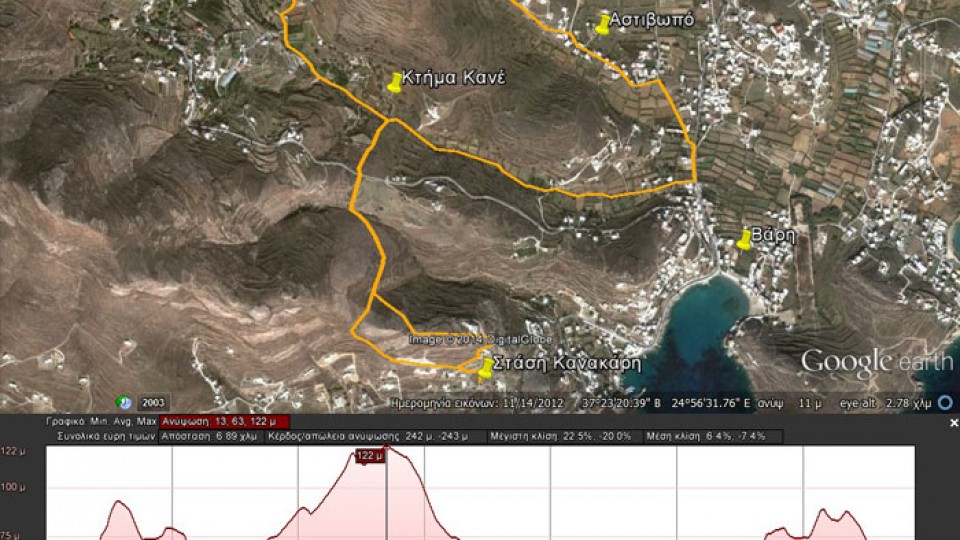
(By Takis Galanopoulos)
The file below, after downloading, requires Google Earth application to view:
STASH_KANAKARH_XROUSSA_BARH
Total path length : 6.890 m.
Altitude at start : 30 m. – Maximum altitude : 122 m.
Total altitude difference : 242 m.
Maximum slope : 22%, average slope : 7 %
For viewing you have to use the Google Earth ... Read More
28
Apr2014
(By Takis Galanopoulos)
The file below, after downloading, requires Google Earth application to view:
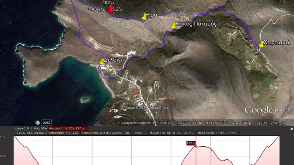
XARTIANA_KAKOS_POTAMOS_DELFINI_KRA
Total path length : 5.070 m.
Altitude Hartiana : 217 m. – Altitude at top of Kra : 182 m.
Total altitude difference : 330 m.
Maximum slope : 34%, average slope : 14 %
For viewing you have to use the ... Read More
07
Apr2014
(By Takis Galanopoulos)
The file below, after downloading, requires Google Earth application to view:
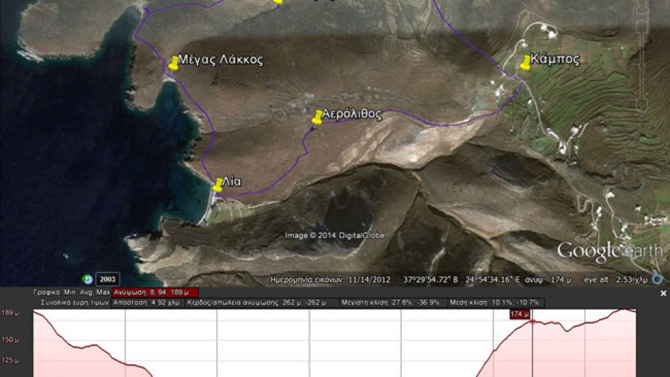
KAMPOS_AEROLIUOS_LIA_MARMARI_DYOSMOS
For viewing you have to use the Google Earth application which can be downloaded here:
http://www.google.gr/intl/el/earth/download/ge/agree.html
17
Mar2014
(By Takis Galanopoulos)
The file below, after downloading, requires Google Earth application to view:
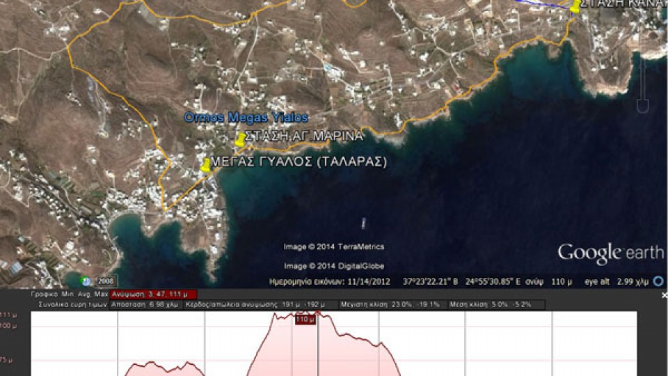
MEGAS GYALOS_TALARAS_ASPROBOUNI_STASH_KANAKARH_1o-EPIPEDO
Total path length : 6.980 m.
Maximum altitude : 111 m.
Total altitude difference : 191 m.
Maximum slope : 23%, average slope : 5 %
For viewing you have to use the Google Earth application which can be downloaded here:
http://www.google.gr/intl/el/earth/download/ge/agree.html
10
Mar2014
(By Takis Galanopoulos)
The file below, after downloading, requires Google Earth application to view:
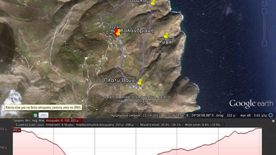
XALANDRIANH_GLYSOYRA_LOYLAS_PLATY_BOYNI
Total path length : 4.550 m.
Altitudes: start at Halandriani =222 m., Glysoura = 0 m., Platy Vouni = 160 m.
Total altitude difference : 258 m.
Maximum slope : 34%, average slope : 11 %
For viewing you have to use ... Read More
16
Feb2014
(By Takis Galanopoulos)
The file below, after downloading, requires Google Earth application to view:
STASH_BAGGELH_NHTES_STASH_KANAKARH_3o_EPIPEDO
For viewing you have to use the Google Earth application which can be downloaded here:
http://www.google.gr/intl/el/earth/download/ge/agree.html
10
Feb2014
The route named Ipi is also known as Sykamia.
(By Takis Galanopoulos)
The file below, after downloading, requires Google Earth application to view:
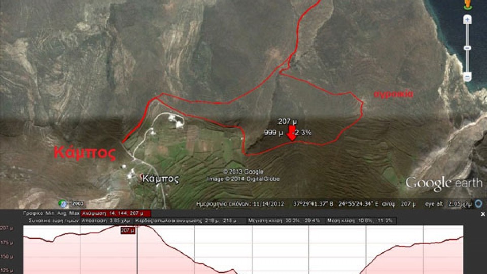
KAMPOS_HPH
For viewing you have to use the Google Earth application which can be downloaded here:
http://www.google.gr/intl/el/earth/download/ge/agree.html
- Previous
- 1
- 2