 English
 Ελληνικα
Καθαρισμός μονοπατιού


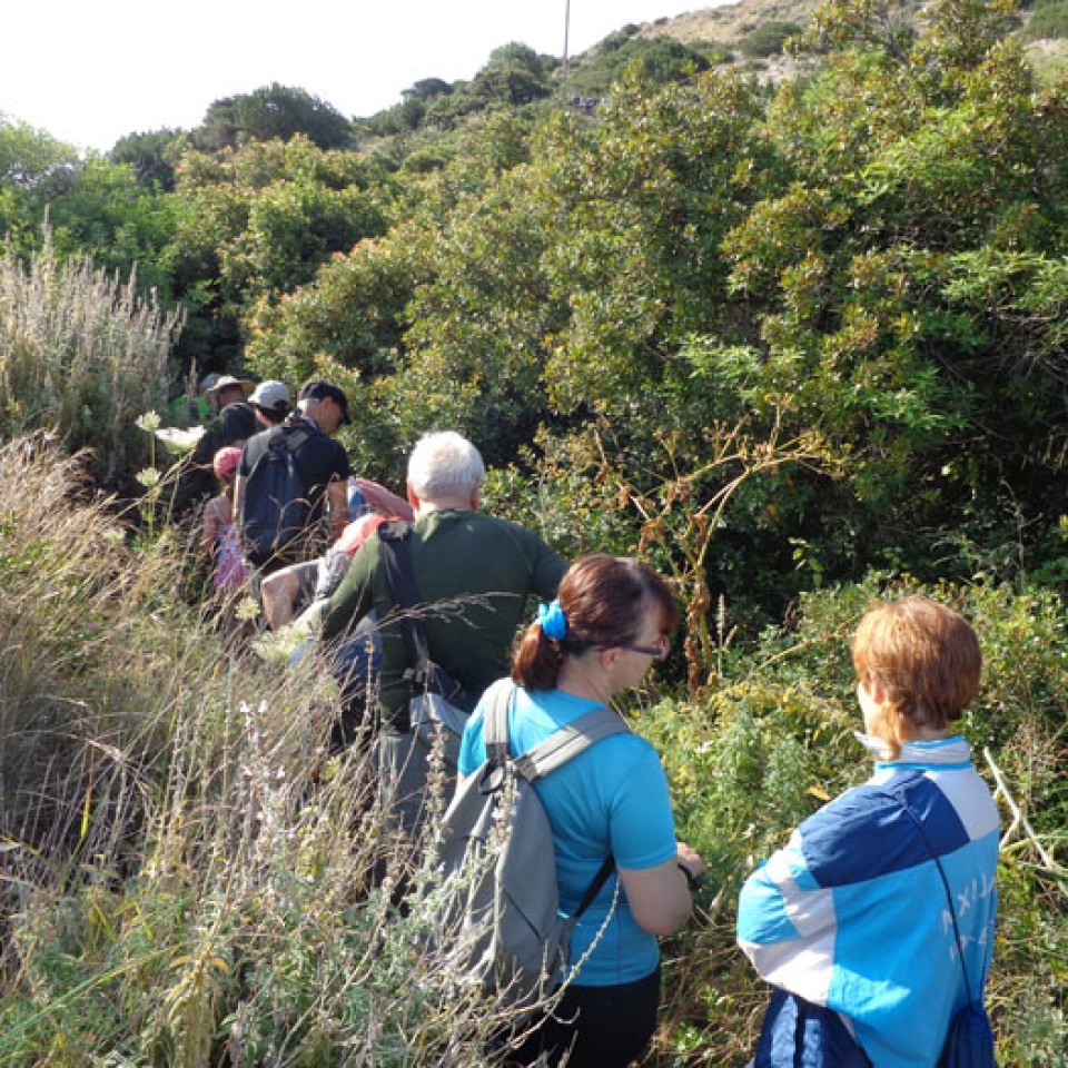
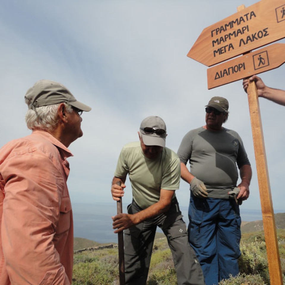
Syros Hiking Team started to place the appropriate signs informing about path.
Already some of the signposts were given from the Municipality of Syros to the team and were placed last Sunday. In the next days more signs will be placed.
(By Takis Galanopoulos)
The file below, after downloading, requires Google Earth application to view:
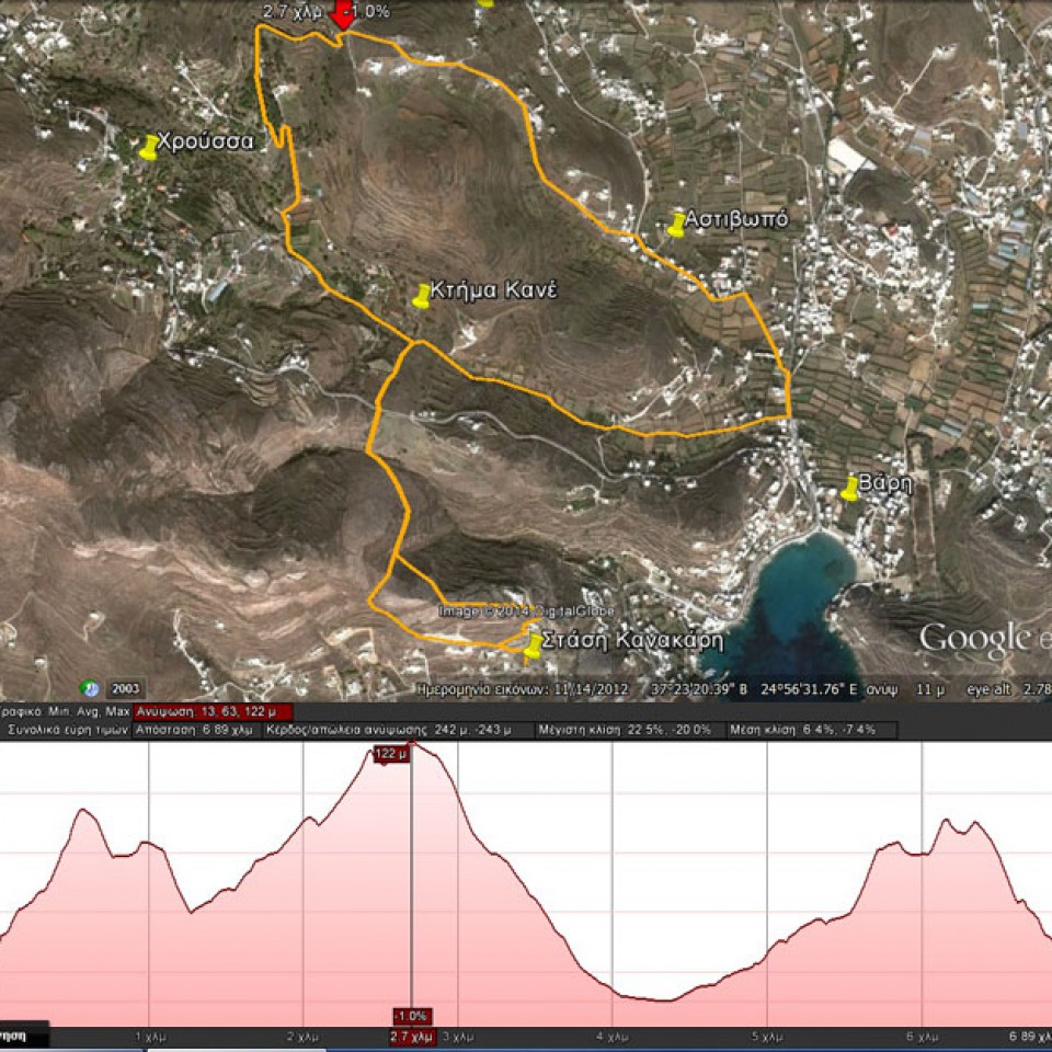
STASH_KANAKARH_XROUSSA_BARH
Total path length : 6.890 m.
Altitude at start : 30 m. – Maximum altitude : 122 m.
Total altitude difference : 242 m.
Maximum slope : 22%, average slope : 7 %
For viewing you have to use the Google Earth ... Read More
(By Takis Galanopoulos)
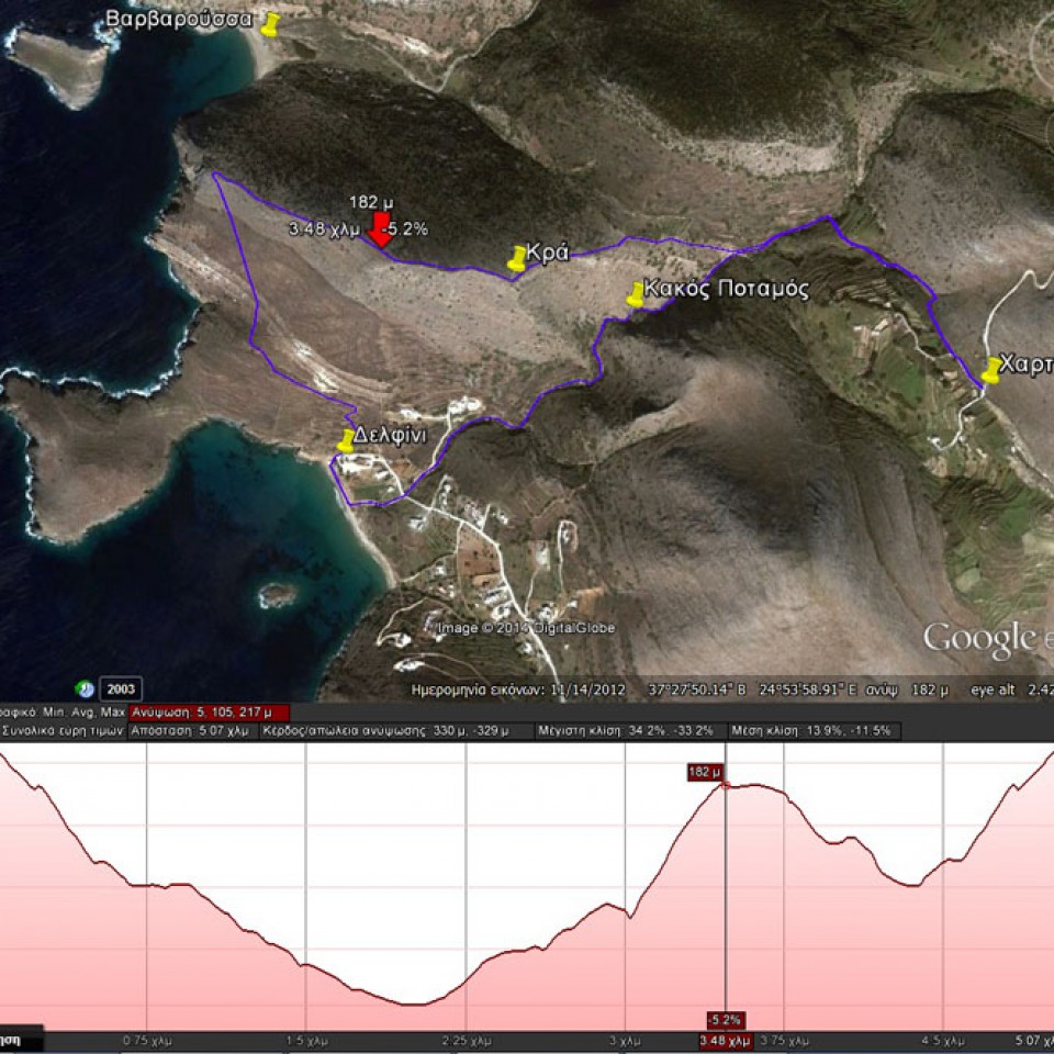
The file below, after downloading, requires Google Earth application to view:
XARTIANA_KAKOS_POTAMOS_DELFINI_KRA
Total path length : 5.070 m.
Altitude Hartiana : 217 m. – Altitude at top of Kra : 182 m.
Total altitude difference : 330 m.
Maximum slope : 34%, average slope : 14 %
For viewing you have to use the ... Read More