 English
 Ελληνικα
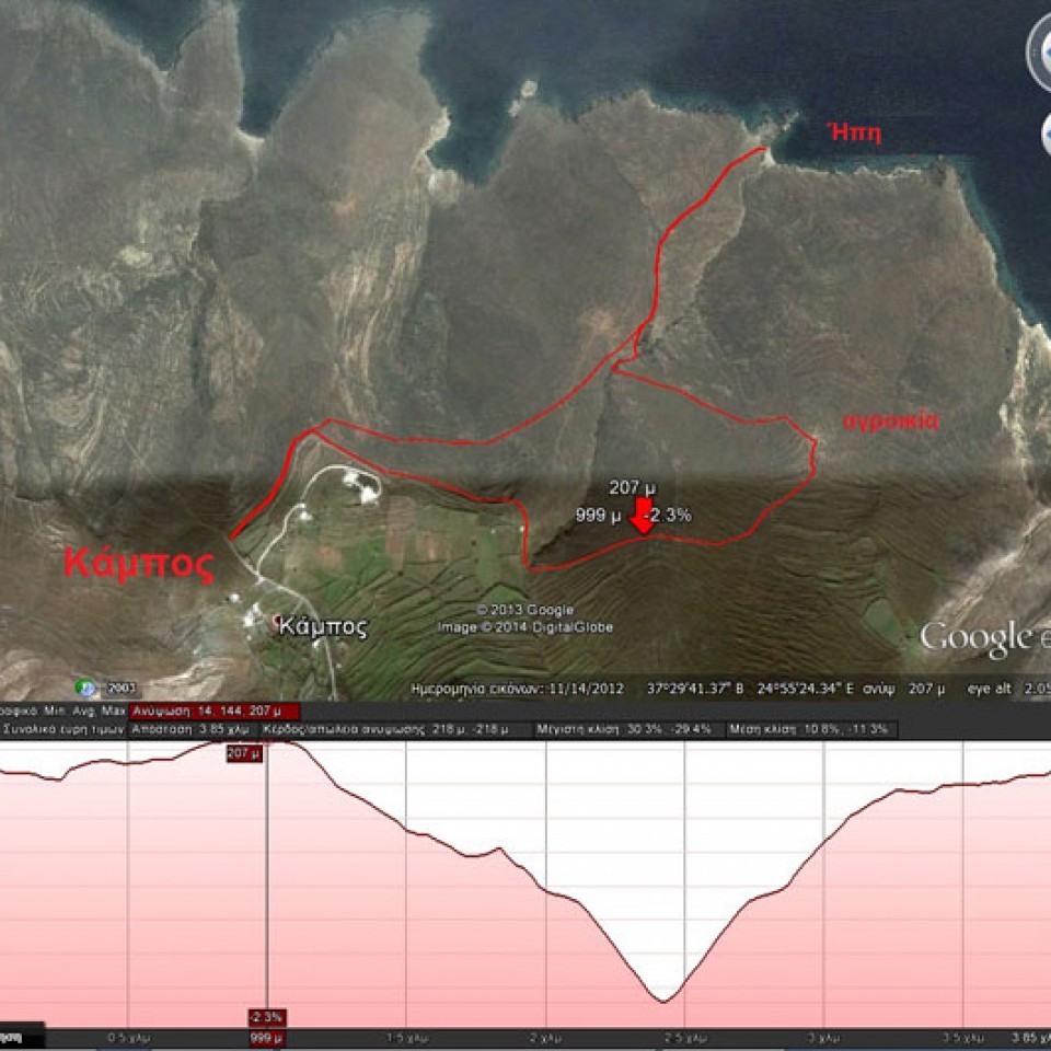
The route named Ipi is also known as Sykamia.
(By Takis Galanopoulos)
The file below, after downloading, requires Google Earth application to view:
KAMPOS_HPH
For viewing you have to use the Google Earth application which can be downloaded here:
http://www.google.gr/intl/el/earth/download/ge/agree.html


Atsiganokastro
Error: The video (http://www.youtube.com/watch?v=umxz7UX9Luk) couldn't be embedded.
Watch the full video of the event from syrostoday.gr:
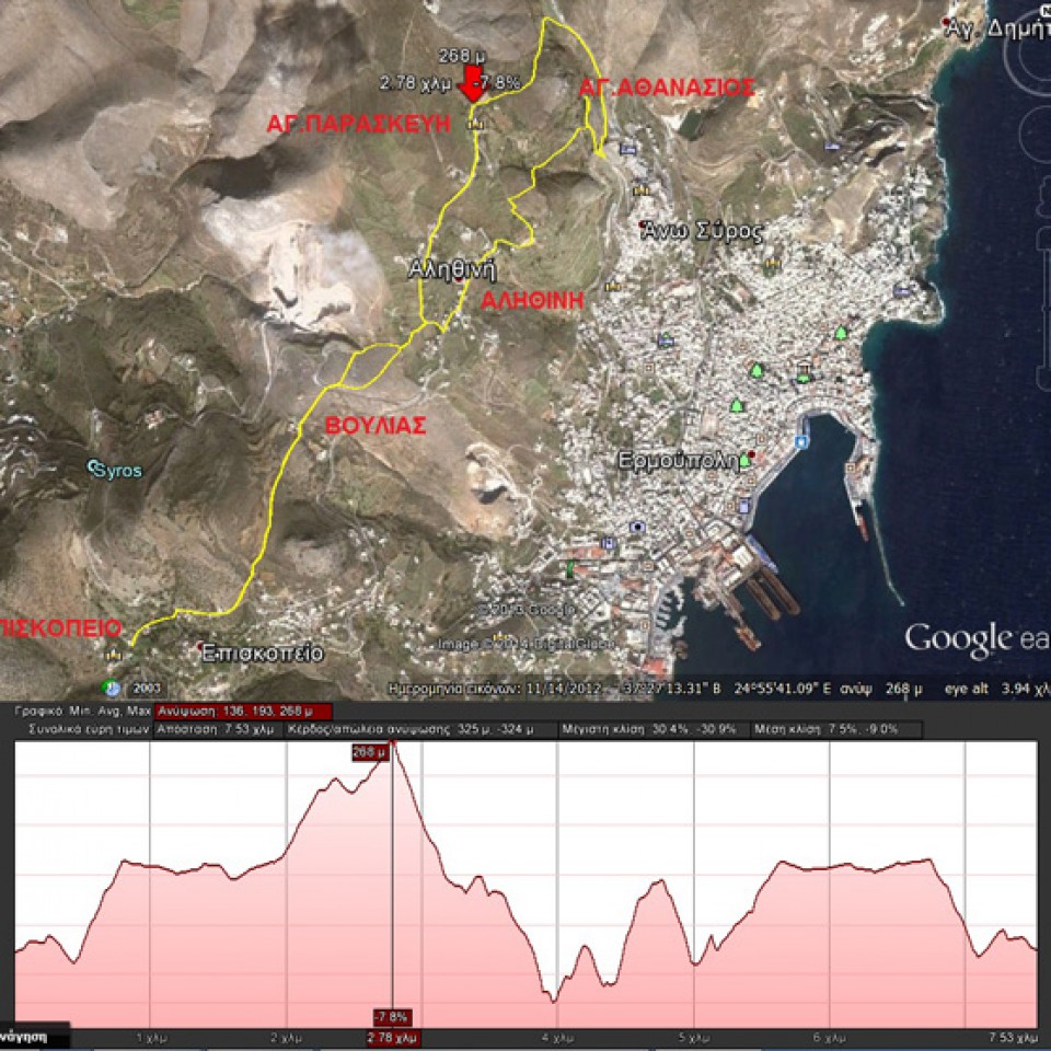
(By Takis Galanopoulos)
The file below, after downloading, requires Google Earth application to view:
PISKOPEIO_BOYLIA_AGIOS_AUANASIOS
Total length (with return) : 7.540 m.
Altitudes: start at Piskopio = 160 m., Max altitude = 267 m. , Min altitude = 135 m.
Total altitude difference : 323 m.
Maximum slope : 30%, average slope : 8 %
For viewing ... Read More