(By Takis Galanopoulos)
The file below, after downloading, requires Google Earth application to view:
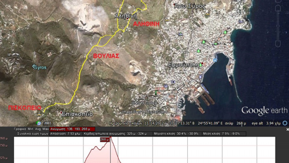
PISKOPEIO_BOYLIA_AGIOS_AUANASIOS
Total length (with return) : 7.540 m.
Altitudes: start at Piskopio = 160 m., Max altitude = 267 m. , Min altitude = 135 m.
Total altitude difference : 323 m.
Maximum slope : 30%, average slope : 8 %
For viewing ... Read More
 English
 Ελληνικα


