 English
 Ελληνικα

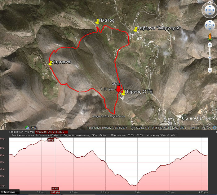
Tavern Margaro – Pyrgos OTE – Hartiana – Platos
(By Takis Galanopoulos)
The file below, after downloading, requires Google Earth application to view:
TAVERNA_MARGARO_PYRGOS_OTE_XARTIANA_PLATOS
Path length : 4.650 m.
Altitude start : 325 μ. – Max altitude : 389 m. – Min Altitude : 216 m.
Total altitude difference : 245 μ.
Maximum slope : 31%, average slope : 11 %
For viewing you have to use the Google Earth application which can be downloaded here:

Comments
No comment yet.